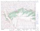
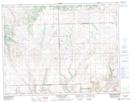
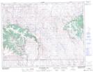
Maps showing Cypress Hills Provincial Forest, Saskatchewan
Cypress Hills Provincial Forest is a Conservation area located in Saskatchewan and has an elevation of 1238 meters.
- Latitude: 49° 36' North (decimal: 49.6000315)
- Longitude: 109° 43' West (decimal: -109.7174216)
- Topography Feature Category: Conservation area
- Geographical Feature: Provincial Forest
- Canadian Province/Territory: Saskatchewan
- Elevation: 1238 meters
- Atlas of Canada Locator Map: Cypress Hills Provincial Forest
- GPS Coordinate Locator Map: Cypress Hills Provincial Forest Lat/Long
Cypress Hills Provincial Forest NTS Map Sheets