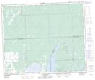
Maps showing Halfway House (Alcott) Provincial Recreation Site, Saskatchewan
Halfway House (Alcott) Provincial Recreation Site is a Conservation area located in Saskatchewan.
- Latitude: 53° 44' 10'' North (decimal: 53.7362019)
- Longitude: 108° 22' 47'' West (decimal: -108.3798512)
- Topography Feature Category: Conservation area
- Geographical Feature: Recreation Site
- Canadian Province/Territory: Saskatchewan
- GPS Coordinate Locator Map: Halfway House (Alcott) Provincial Recreation Site Lat/Long
Halfway House (Alcott) Provincial Recreation Site NTS Map Sheets