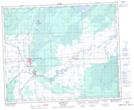
Maps showing Ruby Lake Recreation Site, 46-3-W2, Saskatchewan
Ruby Lake Recreation Site is a Conservation area located in 46-3-W2, Saskatchewan and has an elevation of 366 meters.
- Latitude: 52° 57' 36'' North (decimal: 52.9600204)
- Longitude: 102° 20' 57'' West (decimal: -102.3490851)
- Topography Feature Category: Conservation area
- Geographical Feature: Recreation Site
- Canadian Province/Territory: Saskatchewan
- Elevation: 366 meters
- Location: 46-3-W2
- Atlas of Canada Locator Map: Ruby Lake Recreation Site
- GPS Coordinate Locator Map: Ruby Lake Recreation Site Lat/Long
Ruby Lake Recreation Site NTS Map Sheets