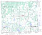
Maps showing St. Walburg Recreation Site, 29-53-22-W3, Saskatchewan
St. Walburg Recreation Site is a Conservation area located in 29-53-22-W3, Saskatchewan.
- Latitude: 53° 36' 1'' North (decimal: 53.6001513)
- Longitude: 109° 12' 5'' West (decimal: -109.2013593)
- Topography Feature Category: Conservation area
- Geographical Feature: Recreation Site
- Canadian Province/Territory: Saskatchewan
- Location: 29-53-22-W3
- Atlas of Canada Locator Map: St. Walburg Recreation Site
- GPS Coordinate Locator Map: St. Walburg Recreation Site Lat/Long
St. Walburg Recreation Site NTS Map Sheets