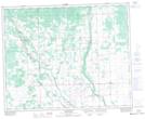
Maps showing Sturgis and District Regional Park (Site 2), 21-35-5-W2, Saskatchewan
Sturgis and District Regional Park (Site 2) is a Conservation area located in 21-35-5-W2, Saskatchewan and has an elevation of 518 meters.
- Latitude: 52° 1' North (decimal: 52.0166574)
- Longitude: 102° 39' West (decimal: -102.6504761)
- Topography Feature Category: Conservation area
- Geographical Feature: Regional Park
- Canadian Province/Territory: Saskatchewan
- Elevation: 518 meters
- Location: 21-35-5-W2
- Atlas of Canada Locator Map: Sturgis and District Regional Park (Site 2)
- GPS Coordinate Locator Map: Sturgis and District Regional Park (Site 2) Lat/Long
Sturgis and District Regional Park (Site 2) NTS Map Sheets