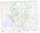
Maps showing Aquadeo, 16-48-17-W3, Saskatchewan
Aquadeo is a Village located in 16-48-17-W3, Saskatchewan and has an elevation of 537 meters.
- Latitude: 53° 8' 14'' North (decimal: 53.1372361)
- Longitude: 108° 25' 30'' West (decimal: -108.4250028)
- Topography Feature Category: Village
- Geographical Feature: Resort Village
- Canadian Province/Territory: Saskatchewan
- Elevation: 537 meters
- Location: 16-48-17-W3
- Atlas of Canada Locator Map: Aquadeo
- GPS Coordinate Locator Map: Aquadeo Lat/Long
Aquadeo NTS Map Sheets