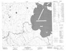
Maps showing Puskwakau River Recreation Site, Saskatchewan
Puskwakau River Recreation Site is a Conservation area located in Saskatchewan.
- Latitude: 54° 30' 38'' North (decimal: 54.5104306)
- Longitude: 103° 31' 40'' West (decimal: -103.5278058)
- Topography Feature Category: Conservation area
- Geographical Feature: Recreation Site
- Canadian Province/Territory: Saskatchewan
- Atlas of Canada Locator Map: Puskwakau River Recreation Site
- GPS Coordinate Locator Map: Puskwakau River Recreation Site Lat/Long
Puskwakau River Recreation Site NTS Map Sheets