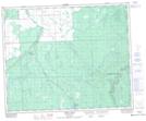
Maps showing Saginas Lake Recreation Site, Saskatchewan
Saginas Lake Recreation Site is a Conservation area located in Saskatchewan.
- Latitude: 52° 30' 36'' North (decimal: 52.5101166)
- Longitude: 102° 13' 44'' West (decimal: -102.2288109)
- Topography Feature Category: Conservation area
- Geographical Feature: Recreation Site
- Canadian Province/Territory: Saskatchewan
- Atlas of Canada Locator Map: Saginas Lake Recreation Site
- GPS Coordinate Locator Map: Saginas Lake Recreation Site Lat/Long
Saginas Lake Recreation Site NTS Map Sheets