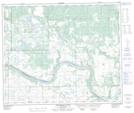
Maps showing Fort Pitt Provincial Park, Saskatchewan
Fort Pitt Provincial Park is a Conservation area located in Saskatchewan and has an elevation of 515 meters.
- Latitude: 53° 34' 19'' North (decimal: 53.5719736)
- Longitude: 109° 47' 33'' West (decimal: -109.7924884)
- Topography Feature Category: Conservation area
- Geographical Feature: Provincial Park
- Canadian Province/Territory: Saskatchewan
- Elevation: 515 meters
- Atlas of Canada Locator Map: Fort Pitt Provincial Park
- GPS Coordinate Locator Map: Fort Pitt Provincial Park Lat/Long
Fort Pitt Provincial Park NTS Map Sheets