Maps showing Lieu historique national du Canada de Frenchman Butte, Saskatchewan
Lieu historique national du Canada de Frenchman Butte is a Conservation area located in Saskatchewan.
- Latitude: 53° 37' 38'' North (decimal: 53.6273136)
- Longitude: 109° 34' 33'' West (decimal: -109.5757612)
- Topography Feature Category: Conservation area
- Geographical Feature: Lieu historique national
- Canadian Province/Territory: Saskatchewan
- Atlas of Canada Locator Map: Lieu historique national du Canada de Frenchman Butte
- GPS Coordinate Locator Map: Lieu historique national du Canada de Frenchman Butte Lat/Long
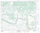
Lieu historique national du Canada de Frenchman Butte NTS Map Sheets