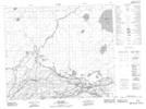
Maps showing Pine Bluff 20A, 21-59-6-W2, Saskatchewan
Pine Bluff 20A is a Indian Reserve located in 21-59-6-W2, Saskatchewan.
- Latitude: 54° 6' 41'' North (decimal: 54.1114956)
- Longitude: 102° 51' 11'' West (decimal: -102.8531675)
- Topography Feature Category: Indian Reserve
- Geographical Feature: Indian Reserve - Réserve indienne
- Canadian Province/Territory: Saskatchewan
- Location: 21-59-6-W2
- Atlas of Canada Locator Map: Pine Bluff 20A
- GPS Coordinate Locator Map: Pine Bluff 20A Lat/Long
Pine Bluff 20A NTS Map Sheets