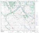
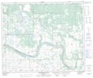
Maps showing Makaoo 120, 23-54,55-27,28-W3, Saskatchewan
Makaoo 120 is a Indian Reserve located in 23-54,55-27,28-W3, Saskatchewan.
- Latitude: 53° 41' 17'' North (decimal: 53.6880632)
- Longitude: 109° 59' 11'' West (decimal: -109.9862875)
- Topography Feature Category: Indian Reserve
- Geographical Feature: Indian Reserve - Réserve indienne
- Canadian Province/Territory: Saskatchewan
- Location: 23-54,55-27,28-W3
- Atlas of Canada Locator Map: Makaoo 120
- GPS Coordinate Locator Map: Makaoo 120 Lat/Long
Makaoo 120 NTS Map Sheets