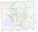
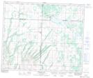
Maps showing Moosomin 112H, N12-47-15-W3, Saskatchewan
Moosomin 112H is a Indian Reserve located in N12-47-15-W3, Saskatchewan.
- Latitude: 53° 3' 41'' North (decimal: 53.0615042)
- Longitude: 107° 58' 50'' West (decimal: -107.9804927)
- Topography Feature Category: Indian Reserve
- Geographical Feature: Indian Reserve - Réserve indienne
- Canadian Province/Territory: Saskatchewan
- Location: N12-47-15-W3
- Atlas of Canada Locator Map: Moosomin 112H
- GPS Coordinate Locator Map: Moosomin 112H Lat/Long
Moosomin 112H NTS Map Sheets