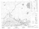
Maps showing Muskeg River 20C, 28,29-58-5-W2, Saskatchewan
Muskeg River 20C is a Indian Reserve located in 28,29-58-5-W2, Saskatchewan.
- Latitude: 54° 3' 56'' North (decimal: 54.0654232)
- Longitude: 102° 39' 11'' West (decimal: -102.6531244)
- Topography Feature Category: Indian Reserve
- Geographical Feature: Indian Reserve - Réserve indienne
- Canadian Province/Territory: Saskatchewan
- Location: 28,29-58-5-W2
- Atlas of Canada Locator Map: Muskeg River 20C
- GPS Coordinate Locator Map: Muskeg River 20C Lat/Long
Muskeg River 20C NTS Map Sheets