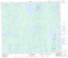
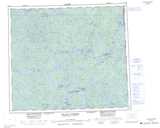
Maps showing Sandy Narrows 184C, 69, 70-7, 8-W2, Saskatchewan
Sandy Narrows 184C is a Indian Reserve located in 69, 70-7, 8-W2, Saskatchewan.
- Latitude: 55° 2' 23'' North (decimal: 55.0396040)
- Longitude: 103° 3' 17'' West (decimal: -103.0546551)
- Topography Feature Category: Indian Reserve
- Geographical Feature: Indian Reserve - Réserve indienne
- Canadian Province/Territory: Saskatchewan
- Location: 69, 70-7, 8-W2
- Atlas of Canada Locator Map: Sandy Narrows 184C
- GPS Coordinate Locator Map: Sandy Narrows 184C Lat/Long
Sandy Narrows 184C NTS Map Sheets