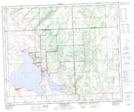
Maps showing Saulteaux 159M, 48-17-W3, Saskatchewan
Saulteaux 159M is a Indian Reserve located in 48-17-W3, Saskatchewan.
- Latitude: 53° 7' 1'' North (decimal: 53.1170520)
- Longitude: 108° 20' 55'' West (decimal: -108.3487348)
- Topography Feature Category: Indian Reserve
- Geographical Feature: Indian Reserve - Réserve indienne
- Canadian Province/Territory: Saskatchewan
- Location: 48-17-W3
- Atlas of Canada Locator Map: Saulteaux 159M
- GPS Coordinate Locator Map: Saulteaux 159M Lat/Long
Saulteaux 159M NTS Map Sheets