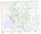
Maps showing Saulteaux 159R, 48-16-W3, Saskatchewan
Saulteaux 159R is a Indian Reserve located in 48-16-W3, Saskatchewan.
- Latitude: 53° 11' 0'' North (decimal: 53.1834275)
- Longitude: 108° 19' 58'' West (decimal: -108.3327261)
- Topography Feature Category: Indian Reserve
- Geographical Feature: Indian Reserve - Réserve indienne
- Canadian Province/Territory: Saskatchewan
- Location: 48-16-W3
- Atlas of Canada Locator Map: Saulteaux 159R
- GPS Coordinate Locator Map: Saulteaux 159R Lat/Long
Saulteaux 159R NTS Map Sheets