Maps showing Thunderchild First Nation 115B, 10,11-52-20-W3, Saskatchewan
Thunderchild First Nation 115B is a Indian Reserve located in 10,11-52-20-W3, Saskatchewan.
- Latitude: 53° 28' 28'' North (decimal: 53.4743765)
- Longitude: 108° 52' 45'' West (decimal: -108.8791568)
- Topography Feature Category: Indian Reserve
- Geographical Feature: Indian Reserve - Réserve indienne
- Canadian Province/Territory: Saskatchewan
- Location: 10,11-52-20-W3
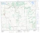
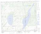
- Atlas of Canada Locator Map: Thunderchild First Nation 115B
- GPS Coordinate Locator Map: Thunderchild First Nation 115B Lat/Long
Thunderchild First Nation 115B NTS Map Sheets