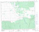
Maps showing Neely Lake Bird Sanctuary, Saskatchewan
Neely Lake Bird Sanctuary is a Conservation area located in Saskatchewan and has an elevation of 419 meters.
- Latitude: 52° 43' North (decimal: 52.7166747)
- Longitude: 102° 48' West (decimal: -102.8004749)
- Topography Feature Category: Conservation area
- Geographical Feature: Migratory Bird Sanctuary
- Canadian Province/Territory: Saskatchewan
- Elevation: 419 meters
- Atlas of Canada Locator Map: Neely Lake Bird Sanctuary
- GPS Coordinate Locator Map: Neely Lake Bird Sanctuary Lat/Long