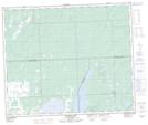
Maps showing Saulteaux First Nation 159II, Saskatchewan
Saulteaux First Nation 159II is a Indian Reserve located in Saskatchewan.
- Latitude: 53° 31' 8'' North (decimal: 53.5188888)
- Longitude: 108° 23' 45'' West (decimal: -108.3958333)
- Topography Feature Category: Indian Reserve
- Geographical Feature: Indian Reserve - Réserve indienne
- Canadian Province/Territory: Saskatchewan
- Atlas of Canada Locator Map: Saulteaux First Nation 159II
- GPS Coordinate Locator Map: Saulteaux First Nation 159II Lat/Long
Saulteaux First Nation 159II NTS Map Sheets