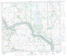
Maps showing Thunderchild First Nation 115F, Saskatchewan
Thunderchild First Nation 115F is a Indian Reserve located in Saskatchewan.
- Latitude: 53° 22' 9'' North (decimal: 53.3692459)
- Longitude: 109° 21' 50'' West (decimal: -109.3639304)
- Topography Feature Category: Indian Reserve
- Geographical Feature: Indian Reserve - Réserve indienne
- Canadian Province/Territory: Saskatchewan
- Atlas of Canada Locator Map: Thunderchild First Nation 115F
- GPS Coordinate Locator Map: Thunderchild First Nation 115F Lat/Long