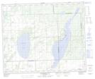
Maps showing Thunderchild First Nation 115J, Saskatchewan
Thunderchild First Nation 115J is a Indian Reserve located in Saskatchewan.
- Latitude: 53° 36' 47'' North (decimal: 53.6129813)
- Longitude: 108° 57' 32'' West (decimal: -108.9588867)
- Topography Feature Category: Indian Reserve
- Geographical Feature: Indian Reserve - Réserve indienne
- Canadian Province/Territory: Saskatchewan
- Atlas of Canada Locator Map: Thunderchild First Nation 115J
- GPS Coordinate Locator Map: Thunderchild First Nation 115J Lat/Long
Thunderchild First Nation 115J NTS Map Sheets