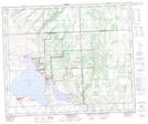
Maps showing Saulteaux First Nation 159Z, Saskatchewan
Saulteaux First Nation 159Z is a Indian Reserve located in Saskatchewan.
- Latitude: 53° 11' 40'' North (decimal: 53.1944505)
- Longitude: 108° 17' 27'' West (decimal: -108.2907945)
- Topography Feature Category: Indian Reserve
- Geographical Feature: Indian Reserve - Réserve indienne
- Canadian Province/Territory: Saskatchewan
- Atlas of Canada Locator Map: Saulteaux First Nation 159Z
- GPS Coordinate Locator Map: Saulteaux First Nation 159Z Lat/Long
Saulteaux First Nation 159Z NTS Map Sheets