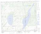
Maps showing Thunderchild First Nation 115U, Saskatchewan
Thunderchild First Nation 115U is a Indian Reserve located in Saskatchewan.
- Latitude: 53° 37' 1'' North (decimal: 53.6169399)
- Longitude: 108° 58' 22'' West (decimal: -108.9728152)
- Topography Feature Category: Indian Reserve
- Geographical Feature: Indian Reserve - Réserve indienne
- Canadian Province/Territory: Saskatchewan
- Atlas of Canada Locator Map: Thunderchild First Nation 115U
- GPS Coordinate Locator Map: Thunderchild First Nation 115U Lat/Long
Thunderchild First Nation 115U NTS Map Sheets