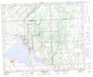
Maps showing Saulteaux 159AA, Saskatchewan
Saulteaux 159AA is a Indian Reserve located in Saskatchewan.
- Latitude: 53° 14' 34'' North (decimal: 53.2428481)
- Longitude: 108° 11' 18'' West (decimal: -108.1884415)
- Topography Feature Category: Indian Reserve
- Geographical Feature: Indian Reserve - Réserve indienne
- Canadian Province/Territory: Saskatchewan
- Atlas of Canada Locator Map: Saulteaux 159AA
- GPS Coordinate Locator Map: Saulteaux 159AA Lat/Long
Saulteaux 159AA NTS Map Sheets