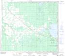
Maps showing Young's Point Provincial Park, 70,71-24-W5, Alberta
Young's Point Provincial Park is a Conservation area located in 70,71-24-W5, Alberta and has an elevation of 688 meters.
- Latitude: 55° 8' 37'' North (decimal: 55.1436111)
- Longitude: 117° 34' 2'' West (decimal: -117.5672221)
- Topography Feature Category: Conservation area
- Geographical Feature: Provincial Park
- Canadian Province/Territory: Alberta
- Elevation: 688 meters
- Location: 70,71-24-W5
- Atlas of Canada Locator Map: Young's Point Provincial Park
- GPS Coordinate Locator Map: Young's Point Provincial Park Lat/Long
Young's Point Provincial Park NTS Map Sheets