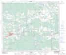
Maps showing Wolf Creek, 2-54-16-W5, Alberta
Wolf Creek is a Unincorporated area located in 2-54-16-W5, Alberta and has an elevation of 872 meters.
- Latitude: 53° 38' 26'' North (decimal: 53.6405555)
- Longitude: 116° 14' 46'' West (decimal: -116.2461111)
- Topography Feature Category: Unincorporated area
- Geographical Feature: Locality
- Canadian Province/Territory: Alberta
- Elevation: 872 meters
- Location: 2-54-16-W5
- Atlas of Canada Locator Map: Wolf Creek
- GPS Coordinate Locator Map: Wolf Creek Lat/Long