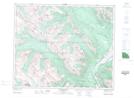
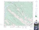
Maps showing Talbot Lake, 47-48-28-W5, Alberta
Talbot Lake is a Lake located in 47-48-28-W5, Alberta and has an elevation of 1046 meters.
- Latitude: 53° 5' 52'' North (decimal: 53.0977778)
- Longitude: 117° 59' 39'' West (decimal: -117.9941666)
- Topography Feature Category: Lake
- Geographical Feature: Lake
- Canadian Province/Territory: Alberta
- Elevation: 1046 meters
- Location: 47-48-28-W5
- Atlas of Canada Locator Map: Talbot Lake
- GPS Coordinate Locator Map: Talbot Lake Lat/Long
Talbot Lake NTS Map Sheets