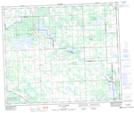
Maps showing Tamarack Lake, 32-56-2-W5, Alberta
Tamarack Lake is a Lake located in 32-56-2-W5, Alberta and has an elevation of 692 meters.
- Latitude: 53° 52' 55'' North (decimal: 53.8819444)
- Longitude: 114° 16' 26'' West (decimal: -114.2738888)
- Topography Feature Category: Lake
- Geographical Feature: Lake
- Canadian Province/Territory: Alberta
- Elevation: 692 meters
- Location: 32-56-2-W5
- Atlas of Canada Locator Map: Tamarack Lake
- GPS Coordinate Locator Map: Tamarack Lake Lat/Long
Tamarack Lake NTS Map Sheets