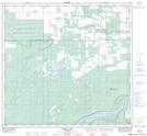
Maps showing Child Lake, 109-16-W5, Alberta
Child Lake is a Lake located in 109-16-W5, Alberta and has an elevation of 309 meters.
- Latitude: 58° 29' 41'' North (decimal: 58.4947222)
- Longitude: 116° 35' 22'' West (decimal: -116.5894444)
- Topography Feature Category: Lake
- Geographical Feature: Lake
- Canadian Province/Territory: Alberta
- Elevation: 309 meters
- Location: 109-16-W5
- Atlas of Canada Locator Map: Child Lake
- GPS Coordinate Locator Map: Child Lake Lat/Long
Child Lake NTS Map Sheets