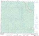
Maps showing Meander River Station, 14-115-22-W5, Alberta
Meander River Station is a Unincorporated area located in 14-115-22-W5, Alberta.
- Latitude: 58° 59' 9'' North (decimal: 58.9858332)
- Longitude: 117° 37' 36'' West (decimal: -117.6266667)
- Topography Feature Category: Unincorporated area
- Geographical Feature: Railway Point
- Canadian Province/Territory: Alberta
- Location: 14-115-22-W5
- Atlas of Canada Locator Map: Meander River Station
- GPS Coordinate Locator Map: Meander River Station Lat/Long
Meander River Station NTS Map Sheets