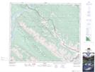
Maps showing Disaster Point, 48-27-W5, Alberta
Disaster Point is a Cape located in 48-27-W5, Alberta.
- Latitude: 53° 10' 1'' North (decimal: 53.1669444)
- Longitude: 117° 58' 26'' West (decimal: -117.9738889)
- Topography Feature Category: Cape
- Geographical Feature: Point
- Canadian Province/Territory: Alberta
- Location: 48-27-W5
- Atlas of Canada Locator Map: Disaster Point
- GPS Coordinate Locator Map: Disaster Point Lat/Long