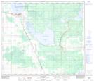
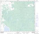
Maps showing Kimiwan Lake, 78-19-W5, Alberta
Kimiwan Lake is a Lake located in 78-19-W5, Alberta and has an elevation of 625 meters.
- Latitude: 55° 45' 18'' North (decimal: 55.7549999)
- Longitude: 116° 55' 1'' West (decimal: -116.9169444)
- Topography Feature Category: Lake
- Geographical Feature: Lake
- Canadian Province/Territory: Alberta
- Elevation: 625 meters
- Location: 78-19-W5
- Atlas of Canada Locator Map: Kimiwan Lake
- GPS Coordinate Locator Map: Kimiwan Lake Lat/Long
Kimiwan Lake NTS Map Sheets