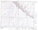
Maps showing Alkali Lake, 24-16-W4, Alberta
Alkali Lake is a Lake located in 24-16-W4, Alberta and has an elevation of 766 meters.
- Latitude: 51° 1' North (decimal: 51.0167000)
- Longitude: 112° 11' West (decimal: -112.1833000)
- Topography Feature Category: Lake
- Geographical Feature: Lake
- Canadian Province/Territory: Alberta
- Elevation: 766 meters
- Location: 24-16-W4
- Atlas of Canada Locator Map: Alkali Lake
- GPS Coordinate Locator Map: Alkali Lake Lat/Long
Alkali Lake NTS Map Sheets