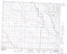
Maps showing Allingham, 34-31-26-W4, Alberta
Allingham is a Unincorporated area located in 34-31-26-W4, Alberta and has an elevation of 896 meters.
- Latitude: 51° 42' 10'' North (decimal: 51.7027777)
- Longitude: 113° 35' 43'' West (decimal: -113.5952778)
- Topography Feature Category: Unincorporated area
- Geographical Feature: Locality
- Canadian Province/Territory: Alberta
- Elevation: 896 meters
- Location: 34-31-26-W4
- Atlas of Canada Locator Map: Allingham
- GPS Coordinate Locator Map: Allingham Lat/Long
Allingham NTS Map Sheets