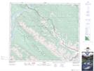
Maps showing Ammonite Creek, 47-27-W5, Alberta
Ammonite Creek is a River located in 47-27-W5, Alberta.
- Latitude: 53° 2' 14'' North (decimal: 53.0372222)
- Longitude: 117° 49' 31'' West (decimal: -117.8252777)
- Topography Feature Category: River
- Geographical Feature: Creek
- Canadian Province/Territory: Alberta
- Location: 47-27-W5
- Atlas of Canada Locator Map: Ammonite Creek
- GPS Coordinate Locator Map: Ammonite Creek Lat/Long