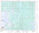
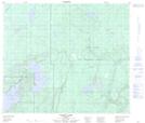
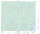
Maps showing Piché River, 69-13-W4, Alberta
Piché River is a River located in 69-13-W4, Alberta and has an elevation of 600 meters.
- Latitude: 55° 1' 13'' North (decimal: 55.0202777)
- Longitude: 111° 50' 35'' West (decimal: -111.8430556)
- Topography Feature Category: River
- Geographical Feature: River
- Canadian Province/Territory: Alberta
- Elevation: 600 meters
- Location: 69-13-W4
- Atlas of Canada Locator Map: Piché River
- GPS Coordinate Locator Map: Piché River Lat/Long
Piché River NTS Map Sheets