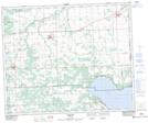
Maps showing Pigeon Lake Provincial Park, 47-1,2-W5, Alberta
Pigeon Lake Provincial Park is a Conservation area located in 47-1,2-W5, Alberta and has an elevation of 861 meters.
- Latitude: 53° 2' 7'' North (decimal: 53.0352777)
- Longitude: 114° 9' 40'' West (decimal: -114.1611111)
- Topography Feature Category: Conservation area
- Geographical Feature: Provincial Park
- Canadian Province/Territory: Alberta
- Elevation: 861 meters
- Location: 47-1,2-W5
- Atlas of Canada Locator Map: Pigeon Lake Provincial Park
- GPS Coordinate Locator Map: Pigeon Lake Provincial Park Lat/Long
Pigeon Lake Provincial Park NTS Map Sheets