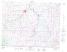
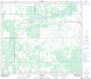
Maps showing Pilling Lake, 4,5-2-25-W4, Alberta
Pilling Lake is a Lake located in 4,5-2-25-W4, Alberta and has an elevation of 1311 meters.
- Latitude: 49° 5' 21'' North (decimal: 49.0891666)
- Longitude: 113° 17' 39'' West (decimal: -113.2941666)
- Topography Feature Category: Lake
- Geographical Feature: Lake
- Canadian Province/Territory: Alberta
- Elevation: 1311 meters
- Location: 4,5-2-25-W4
- Atlas of Canada Locator Map: Pilling Lake
- GPS Coordinate Locator Map: Pilling Lake Lat/Long
Pilling Lake NTS Map Sheets