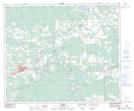
Maps showing Pinedale, 53-15-W5, Alberta
Pinedale is a Unincorporated area located in 53-15-W5, Alberta and has an elevation of 928 meters.
- Latitude: 53° 36' 1'' North (decimal: 53.6003000)
- Longitude: 116° 8' 45'' West (decimal: -116.1457999)
- Topography Feature Category: Unincorporated area
- Geographical Feature: Former Locality
- Canadian Province/Territory: Alberta
- Elevation: 928 meters
- Location: 53-15-W5
- Atlas of Canada Locator Map: Pinedale
- GPS Coordinate Locator Map: Pinedale Lat/Long