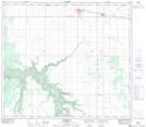
Maps showing Donnelly, 78-20,21-W5, Alberta
Donnelly is a Village located in 78-20,21-W5, Alberta and has an elevation of 594 meters.
- Latitude: 55° 43' 44'' North (decimal: 55.7288888)
- Longitude: 117° 6' 17'' West (decimal: -117.1047221)
- Topography Feature Category: Village
- Geographical Feature: Village
- Canadian Province/Territory: Alberta
- Elevation: 594 meters
- Location: 78-20,21-W5
- Atlas of Canada Locator Map: Donnelly
- GPS Coordinate Locator Map: Donnelly Lat/Long