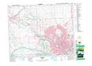
Maps showing Dover, Alberta
Dover is a Unincorporated area located in Alberta and has an elevation of 1059 meters.
- Latitude: 51° 2' North (decimal: 51.0333333)
- Longitude: 113° 58' West (decimal: -113.9666666)
- Topography Feature Category: Unincorporated area
- Geographical Feature: Urban Community
- Canadian Province/Territory: Alberta
- Elevation: 1059 meters
- Atlas of Canada Locator Map: Dover
- GPS Coordinate Locator Map: Dover Lat/Long
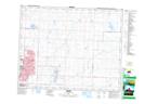
Dover NTS Map Sheets