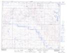
Maps showing Dowling Lake, 34-32-16-W4, Alberta
Dowling Lake is a Unincorporated area located in 34-32-16-W4, Alberta.
- Latitude: 51° 47' North (decimal: 51.7833332)
- Longitude: 112° 11' West (decimal: -112.1833333)
- Topography Feature Category: Unincorporated area
- Geographical Feature: Locality
- Canadian Province/Territory: Alberta
- Location: 34-32-16-W4
- Atlas of Canada Locator Map: Dowling Lake
- GPS Coordinate Locator Map: Dowling Lake Lat/Long
Dowling Lake NTS Map Sheets