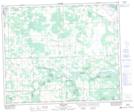
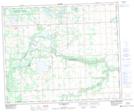
Maps showing Kitto Lake, 29-50-5-W5, Alberta
Kitto Lake is a Lake located in 29-50-5-W5, Alberta and has an elevation of 767 meters.
- Latitude: 53° 20' 21'' North (decimal: 53.3391666)
- Longitude: 114° 42' 8'' West (decimal: -114.7022222)
- Topography Feature Category: Lake
- Geographical Feature: Lake
- Canadian Province/Territory: Alberta
- Elevation: 767 meters
- Location: 29-50-5-W5
- Atlas of Canada Locator Map: Kitto Lake
- GPS Coordinate Locator Map: Kitto Lake Lat/Long
Kitto Lake NTS Map Sheets