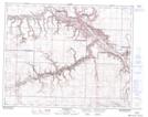
Maps showing Kneehill, 9-29-20-W4, Alberta
Kneehill is a Unincorporated area located in 9-29-20-W4, Alberta and has an elevation of 693 meters.
- Latitude: 51° 27' 50'' North (decimal: 51.4638889)
- Longitude: 112° 45' 17'' West (decimal: -112.7547222)
- Topography Feature Category: Unincorporated area
- Geographical Feature: Locality
- Canadian Province/Territory: Alberta
- Elevation: 693 meters
- Location: 9-29-20-W4
- Atlas of Canada Locator Map: Kneehill
- GPS Coordinate Locator Map: Kneehill Lat/Long
Kneehill NTS Map Sheets