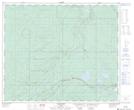
Maps showing Apetowun Creek, 12-54-23-W5, Alberta
Apetowun Creek is a River located in 12-54-23-W5, Alberta and has an elevation of 1191 meters.
- Latitude: 53° 38' 37'' North (decimal: 53.6436111)
- Longitude: 117° 15' 42'' West (decimal: -117.2616667)
- Topography Feature Category: River
- Geographical Feature: Creek
- Canadian Province/Territory: Alberta
- Elevation: 1191 meters
- Location: 12-54-23-W5
- Atlas of Canada Locator Map: Apetowun Creek
- GPS Coordinate Locator Map: Apetowun Creek Lat/Long