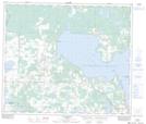
Maps showing Plamondon Creek, 12-68-16-W4, Alberta
Plamondon Creek is a River located in 12-68-16-W4, Alberta and has an elevation of 581 meters.
- Latitude: 54° 52' 32'' North (decimal: 54.8755555)
- Longitude: 112° 17' 54'' West (decimal: -112.2983332)
- Topography Feature Category: River
- Geographical Feature: Creek
- Canadian Province/Territory: Alberta
- Elevation: 581 meters
- Location: 12-68-16-W4
- Atlas of Canada Locator Map: Plamondon Creek
- GPS Coordinate Locator Map: Plamondon Creek Lat/Long
Plamondon Creek NTS Map Sheets