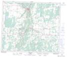
Maps showing Plum Lake, 64,65-21-W4, Alberta
Plum Lake is a Lake located in 64,65-21-W4, Alberta.
- Latitude: 54° 34' 11'' North (decimal: 54.5697222)
- Longitude: 113° 2' 30'' West (decimal: -113.0416667)
- Topography Feature Category: Lake
- Geographical Feature: Lake
- Canadian Province/Territory: Alberta
- Location: 64,65-21-W4
- Atlas of Canada Locator Map: Plum Lake
- GPS Coordinate Locator Map: Plum Lake Lat/Long
Plum Lake NTS Map Sheets