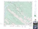
Maps showing Pocahontas, 6-49-27-W5, Alberta
Pocahontas is a Unincorporated area located in 6-49-27-W5, Alberta and has an elevation of 1002 meters.
- Latitude: 53° 12' 18'' North (decimal: 53.2049999)
- Longitude: 117° 55' 34'' West (decimal: -117.9261110)
- Topography Feature Category: Unincorporated area
- Geographical Feature: Locality
- Canadian Province/Territory: Alberta
- Elevation: 1002 meters
- Location: 6-49-27-W5
- Atlas of Canada Locator Map: Pocahontas
- GPS Coordinate Locator Map: Pocahontas Lat/Long