Canada Topographic Maps

Ghostpine Creek Topo Maps

Topography maps and Latitude/Longitude Location

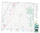
Maps showing Ghostpine Creek, Alberta

Ghostpine Creek is a River located in Alberta.

  • Latitude: 51° 32' North   (decimal: 51.5332999)
  • Longitude: 112° 53' West   (decimal: -112.8832999)
  • Topography Feature Category: River
  • Geographical Feature: Creek
  • Canadian Province/Territory: Alberta
  • GPS Coordinate Locator Map: Ghostpine Creek Lat/Long

Ghostpine Creek NTS Map Sheets

082P10 Munson Topographic Map at 1:50,000 scale

082P11 Three Hills Topographic Map at 1:50,000 scale

082P13 Torrington Topographic Map at 1:50,000 scale

082P14 Trochu Topographic Map at 1:50,000 scale

083A04 Innisfail Topographic Map at 1:50,000 scale

082P Drumheller Topographic Map at 1:250,000 scale

083A Red Deer Topographic Map at 1:250,000 scale

 
Buy Topographic Maps DVD
Newsletter Sign-up

Yes, I want to receive map store discounts.


Bookmark and Share